|
Natural splendor abounds on the most spring-fed river in the Missouri Ozark Mountains. Regardless of your skill level, you can relax and enjoy the solitude, and let the timeless beauty of the river captivate your spirit as the casual current carries you along this 55-mile scenic excursion through the Missouri Ozark Mountains. As your down-river passage progresses to the junction where the Current meets the Jacks Fork, you’ll find gravel bars that will entice you to stop for a picnic, relax on the beach, or go for a swim in the pristine waters. Adventurers will enjoy setting up camp and spending the night in this secluded river paradise before reaching their final destination—Two Rivers Canoe Rental and General Store. Shorter excursions are available on the Current River as well. Whether you spend an hour, day, or week camping along the river, you can be certain that the memories will last a lifetime. YEAR-ROUND ADVENTURES Spring and summer months are spectacular on the Current River. The beautiful autumn colors peak in mid-October, and wintertime floats are amazing, especially when snow completely covers the ground. As you journey down-river, rare plants, spectacular caves, steep bluffs, and hidden coves will captivate your imagination. You’ll find breathtaking scenery that is alive with deer, turkey, raccoons, and other wildlife. If you look closely, you may even catch a glimpse of a Bald Eagle or the wild horses that roam freely along the rivers. You won’t want to forget your camera on this picturesque adventure. The Current River also offers world-renowned fishing year round. Catch everything from Trout, Goggle Eye, and Perch to Small Mouth Bass. HOW THE CURRENT RIVER GOT ITS NAME Many names come from the early French explorers and trappers in the area. The trappers placed their traps in "La Riviere Courant," the "Running River."
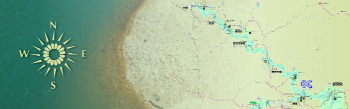
Download Our Two Rivers Area Float Trip Map Current River Data from the National Park Service |
||||||||||||||||||||||||